Hong Kong International Airport (HKG)
Orientation and Maps
(Hong Kong, China)
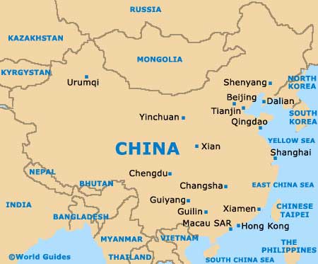
The part of China known as the Hong Kong Special Administrative Region covers a vast area of more than 1,000 square kilometres / 386 square miles, and is actually home to approximately seven million locals. In total, this Hong Kong region encompasses more than 250 different islands, in all shapes and sizes, and Hong Kong itself can be found in the Pearl River Delta area, on the south-eastern shoreline of China.
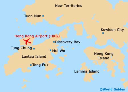
On the south-western side of the city, Hong Kong International Airport (HKG) is the region's main airport and also goes by the name Chek Lap Kok Airport, due to its location. A massive complex with capabilities exceeding 50 million passengers each year, the award-winning Hong Kong Airport serves many local Chinese airlines and only opened commercially in 1998.
Hong Kong International Airport (HKG) Maps: Important City Districts
Noteworthy districts and regions include Hong Kong Island. Dominated by the Victoria Peak mountain, where the views of the cityscape are truly breathtaking, other island highlights include the Colonial-style buildings, the lively restaurants and nightlife around both Soho and Wanchai, and the recreational areas on the southern side.
Kowloon is an especially popular area of Hong Kong and features nine main hills. Enjoying a peninsula setting, Kowloon's Tsim Sha Tsui area is particularly tourist-friendly, with a host of waterfront attractions overlooking Victoria Harbour and beyond. The New Territories make up roughly three-quarters of the entire Hong Kong Special Administrative Region and is fairly sparsely populated in comparison to the main city area. The Fung Ying Sin Koon Temple is especially prominent and is located in the Fanling area, while Tai Po is worth a visit for its colourful market alone.
China Map
Hong Kong Map